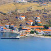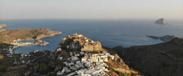
Psara is a tiny speck in the Aegean sea northwest of Chios. This island of scrub vegetation, wandering goats and weird red rock formations has one settlement which also called Psara, a remote monastery and pristine beaches. Little Psara looms inordinately large in modern lore. The Psariot clans became wealthy through shipping, and their participation in the 1821–29 War of Independence is etched into modern Greek history, particularly the daring exploits of Konstantinos Kanaris (1793–1877) whose heroic stature propelled him, six times, to the position of prime minister. In the center of Psara village stands the monument of Konstantinos Kanaris to honour his great achievements.
The remote Monastery of “Kimisis Theotokou” is located about 12 kilometres north of the Psara town. That small chapel which is the main cultural attraction on Psara, is surrounded by protective walls, containing rare hieratric scripts from Mt Athos and a sacred icon which is celebrated with a parade on 4th August.
The village on Psara is tucked within a long bay on the island’s southwest. Your first sight when you visit Psara is the jagged Mavri Rachi, the rock from which thousands of Psariots are said to have hurled themselves during the 1824 Ottoman assault.
West of the southwestern edge of Psara lies the Antipsara island, a very small island of the eastern Aegean. Antipsara belongs to the municipality PSARA Regional Chios Unit.
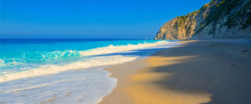
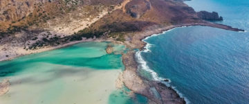
On the island there are no large trees but low enough bushes. There are organized farmland for cultivation of wheat and barley. Also used for grazing Sheep and goats. It has also two churches and a water tank in the west for farming occupations. On the island there are traces of exploitation of the 4th century. Notable are the magnificent beaches like Limionas, Ai Yannis Psili Ammos and the beach of the priest Andrea.
Psara island is located 25 miles northwest of Chios island. The specific geographic coordinates of Psara are 38°24’00.0″N 26°01’00.0″E in Aegean Sea.

